The Okanogan Highlands
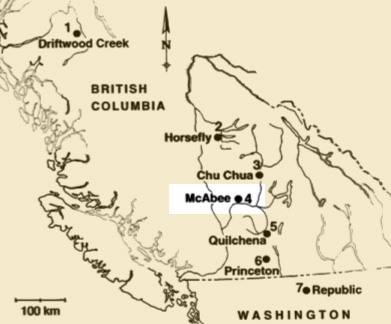
McAbee is only one of a group of localities extending approximately 1,200 kilometers from central Washington north into central British Columbia. These locations have been determined to be close in age through radiometric dating and floral comparisons. Each site is different because of the microclimate specific to that area, whether the fossils were deposited near to shore or deep in the lake and the type of sediments preserving the fossils. By understanding what occurs at each deposit and then making comparisons we can build a broader picture of the forest that covered the entire region.